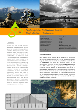
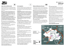
SENTIERO DEI GAS Si percorre in macchina la Statale fino al ponte LEFA’ e si gira a sinistra per il parcheggio della Chiesa di San Giorgio (cippo funerario di una donna romana). Di fronte al parcheggio si scende verso il Golf, si gira a sinistra per circa 100 mt, si svolta a destra per Mornaga, si gira a sinistra e si attraversa il centro abitato di Mornaga, fino alla località Santo Nero e si scende a sinistra fino sulla strada comunale del Golf e si entra a Cecina. Si imbocca la prima strada a sinistra e dopo pochi metri la seconda a sinistra ritornando alla Chiesa di San Giorgio percorrendo la strada panoramica di Messaga. Gas deriva da GAHAGI termine di origine longobarda che indica un campo recintato dove si radunavano i cavalli. Percorribile Difficoltà Tempo di percorrenza Lunghezza Dislivello a Piedi e Mountain bike Facile 1:20 ore 4 km 100 m RAD - UND WANDERWEG „GAS“ Fahren Sie bis zur Brücke „Lefà”, die sich an der Grenze zwischen Toscolano und Gargnano befindet. Hier biegen Sie nach links ab und fahren bis zum Parkplatz der Kirche S.Giorgio . Hier können Sie den Grabstein einer römischen Frau sehen. Gehen Sie 100 m zurück.An der Abzweigung unterhalb des Parkplatzes biegen Sie nach links ab auf die Straße zum Golfplatz . Gehen Sie auf dieser Straße und nach ca. 100 m biegen Sie in die Straße rechts Richtung Mornaga. Gehen Sie den Ort Mornaga hindurch, bis zum Ortsteil Santo Nero. Hier nehmen Sie die Straße links, die Sie hinunter zum Golfplatz bringt. Rechts von Ihnen liegt das Dorf Cecina. Hier nehmen Sie die erste Straße links und, nach wenigen Metern, die zweite Straße links, die Sie auf der Panoramastraße von Messaga zurück zur Kirche S.Giorgio führt. Das Wort „Gas“ ist langobardischen Ursprungs und bezeichnet einen eingezäunten Pferdesammelplatz. Weg Schwierigkeit Laufzeit Länge Höhenunterschied zu Fuß & MBT Leicht 1:20 h 4 km 100 m SENTIERO DEI GAS Drive along the main road SS45 bis as far as Ponte Lefà and turn left to the parking lot of the Church of San Giorgio (a memorial stone of a Roman woman can be seen there). Go down the path beside the parking lot to the golf courses, turn left and continue for about 100m., turn right to Mornaga, turn left and go through the hamlet of Mornaga, reaching the locality of Santo Nero and go down to the left until you reach the council road flanking the golf courses . Turn right into Cecina. Take the first left and after a few metres the second left, which will lead you back to the Church of S. Giorgio along the panoramic road of Messaga. Gas comes from the Longobard word GAHAGI meaning a fenced field where horses were gathered stacked. Of particular interest is the room where a former worker of the papermill shows how a paper sheet was produced. Viable by Difficulty Avarange time Length Drop foot & MTB Easy 1:20 h 4km 100 m Bivio sx Bivio sx W4 W3 Santo Nero Mornaga Chiesa di S.Giorgio compatibile GPS coordinate UTM W1
Scarica

