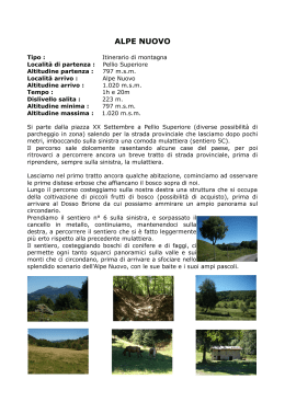
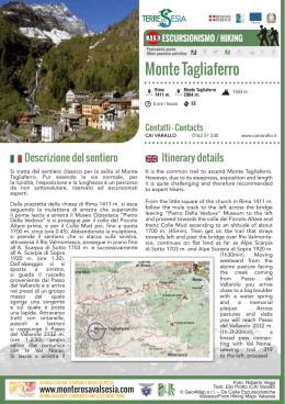
261 ESCURSIONISMO / HIKING
Praticabile anche
Other possible activities
Colle del Laghetto
Rassa
914 m.
Colle del Laghetto
2535 m.
4 1/2 ore / hours
E
Contatti - Contacts
CAI VARALLO
Descrizione del sentiero
Dal parcheggio di Rassa 914 m., si segue la carrozzabile che percorre il fondo della Val Gronda e si giunge
nei pressi della cappella dei "Riveit" 1120 m.,
da cui si stacca l'itinerario 262 per la Val Sassolenda
(ore 0,40). Si continua su di una buona mulattiera
(261) che valica il torrente Sassolenda su un ponte di
ferro e poco dopo tocca le frazioni Rassetta e Fontana. Si prosegue su un sentiero ben tracciato fino
all'Alpe Concrenno 1280 m. (ore 0,30-1,10), in leggera salita si passa per gli alpi Goreto, Straighe e
Casere 1514 m. (ore 0,40-1,50) dove la valle sembra
interrompersi bruscamente per cedere il posto a
scoscese pareti rocciose, detriti di falda e ripidi
pascoli. Il sentiero sale ripido verso destra al fianco di
una cascatella, entra in un valloncello, guada il
Torrente Gronda e porta nei pressi dell’ Alpe Salei
1707 m., punto tappa CAI visibile poco sopra.
Si guada nuovamente il torrente e con un tratto sul
cono detritico si giunge all'Alpe Piana d'Ovago 1748
m. (ore 0,30-2,20), per poi inerpicarsi sul ripido
costone che porta all'Alpe del Lago 2061 m. (ore
0,50-3,10). Con una breve salita, lasciando a sinistra
l'itinerario 265 a quota 2100 m. circa, si piega
a destra obliquamente per arrivare al Lago della Seja
2161
m.
(ore
0,20-3,30),
esteso
e profondo specchio
d'acqua. Il percorso
sale con brevi tornanti al Lago “Il Laghetto” 2366 m. (ore
0,30-4,00) e con
un ultimo faticoso
strappo porta al
Colle del Laghetto
2539
m.
(ore
0,30-4,30), da dove
si scende nel Vallone
del Maccagno ed in
Val Vogna
(Riva Valdobbia).
SCARICA CARTINE, ITINERARI E MOLTO ALTRO SU
www.monterosavalsesia.com
DOWNLOAD MAPS, ITINERARIES AND A LOT MORE FROM
1618 m.
0163 51 530
www.caivarallo.it
Itinerary details
From the car park area in Rassa at 914 m., follow
the road along the Val Gronda valley floor to the little
“Riveit” chapel at 1120 m. at which point the itinerary
strays from trail 262 towards Val Sassolenda (40 min).
Continuing along the mule track (261) that crosses
over the Sassolenda creek on an iron bridge the trail
leads quickly to the hamlets Rassetta and Fontana.
The well-marked trail continues to Alpe Concrenno
at 1280 m. (30min-1h10min), and on a gradual
upward slope past the pastures of Goreto, Straighe
and Casere at 1514 m. (40min-1h50min) where
the valley seems to be abruptly superseded by steep
rocky walls, debris layers and hilly meadows. The trail
ascends along a steep slope towards the right next
to a little waterfall then it enters a small gorge, wades
through the Gronda creek and leads to the pastures
of Alpe Salei at 1707 m. A little farther up is a CAI
(Italian Alpine Club) site. Once again, the creek
is waded through and after a tract on the debris cone,
at 1748 m., the Alpe Piana d’Ovago is reached
(30min-2h20min) and then clambers up the steep
hillside that leads to Alpe del Lago at 2061 m.
(50min-3h10min). After a short climb, leaving trail 265
at an elevation of approximately 2100 m., obliquely
towards the right is the
deep and wide Lago
della Seja lake at 2161
m.
(20min-3h30min).
The trail continues
upward with sharp
bends at “Il Laghetto”,
2366 m. (30min-4h),
and
with
a
final
strenuous stretch to the
Colle del Laghetto
at 2539 m. (30min4h30min) the descent
begins toward the
Vallone del Maccagno
and Val Vogna (Riva
Valdobbia).
Foto: Roberto Veggi
Testi: Elio Protto (CAI Varallo)
© Geo4Map s.r.l. – Da Carte Escursionistiche
Valsesia/From Hiking Maps Valsesia
550 ESCURSIONISMO / HIKING
Praticabile anche
Other possible activities
Bonda Piatta
da S. Gottardo di Rimella
S. Gottardo
1329 m.
Bonda Piatta
1930 m.
2.30 ore / hours
E
Contatti - Contacts
CAI VARALLO
Descrizione del sentiero
Collega Rimella con il territorio di Sabbia e Cravagliana, è
un itinerario alternativo per salire al Monte Capio
evitando il canalino attrezzato. Da Rimella si segue la
strada per la graziosa frazione di S.Gottardo 1329 m., la si
attraversa e si prende il sentiero che tra prati e campi
coltivati porta in salita all'Alpe Selletta 1447 m. Tenendosi
sul sentiero in basso si raggiunge l'A. Van e la panoramica
A. Versch 1525 m. Il sentiero, prima in piano e poi in
discesa, si dirige verso il centro del vallone e attraversa
numerosi avvallamenti percorsi da ruscelli.
Si guada infine il Rio Pianello e sulla sponda opposta si
sale
zigzagando
sul
ripido
pendio
fino
a raggiungere le baite dell'A. Ratte 1694 m. (ore 1). Dalla
baita
più
elevata
si
prosegue
a
sinistra
e si raggiunge una dorsale erbosa sottostante
l'A. Pianello, si raggiunge l'A. Sinanecca a 1748 m. dove
si incrocia l'itinerario 549, ci si mantiene
sul sentiero più basso e con un largo semicerchio
si contorna l'avvallamento percorso dal torrente
Enderwasser fino a portarsi sotto un'esposta bastionata
rocciosa,
localmente
chiamata Passo Brutto.
Superato questo passaggio obbligato ed attrezzato nel 2014 con catene, si
rientra su pendio erboso,
si attraversa un canalino
invaso da detriti e si
giunge infine alla sella
erbosa della Bonda Piatta
1930 m., chiamata dai
rimellesi Rassumbundamji
(ore 1 – ore 2).
Da questo valico si può
scendere all'A. Laghetto
1810 m., entro la Valbella.
Volgendo
invece
a sinistra, per facile cresta
erbosa, in poco più di
mezz'ora si raggiunge la
cima del M. Capio 2172 m.
SCARICA CARTINE, ITINERARI E MOLTO ALTRO SU
www.monterosavalsesia.com
DOWNLOAD MAPS, ITINERARIES AND A LOT MORE FROM
601 m.
0163 51 530
www.caivarallo.it
Itinerary details
This is an itinerary connecting Rimella to the area of
Sabbia and Cravagliana; it is an alternative itinerary to
climb Monte Capio excluding the steep gully with fixed
ropes. From Rimella follow the road to the lovely hamlet
of S.Gottardo 1329 m., then take the path amidst the
grassland and cultivated fields that climbs up to Selletta
Alp 1447 m. Proceeding on the lower trail you will reach
A. Van and the panoramic A. Versch 1525 m. The trail
slopes down towards the centre of the deep valley
and across a number of hollows with waterstreams.
Then facing Rio Pianello the trail winds up steeply on
the opposite side leading to the huts of A. Ratte 1694 m.
(1 hour). From the hut located in the highest position
proceed to the left as far as a grassy ridge below
A. Pianello, and you will reach A. Sinanecca 1748 m.
where the trail intersects with the route n. 549, stay on the
lowest trail that in semi circle goes around the hollow
traversed by the Enderwasser torrent and proceed as far
as you get below an exposed rock rampart locally known
as Passo Brutto. After this obligatory passageway
equipped with chains
in 2014, the trail
continues on the
grassy slope then
across a gully full of
rubbles and finally
arrives at the grassy
saddle of the Bonda
Piatta 1930 m., called
Rassumbundamji by
the villagers of Rimella
(1 - 2 hours). From this
pass you can descend
to A. Laghetto 1810
m., within the Valbella
valley. While following
the the grassy ridge
on the left you can
easily
reach
the
summit of M. Capio
2172 m. in a bit more
than half an hour.
Foto: Roberto Veggi
Testi: Elio Protto (CAI Varallo)
© Geo4Map s.r.l. – Da Carte Escursionistiche
Valsesia/From Hiking Maps Valsesia
Scarica