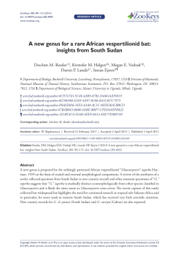
93
by W.J. Kennedy1, I. Walaszczyk2, and W.A. Cobban3 *
The Global Boundary Stratotype Section and
Point for the base of the Turonian Stage of the
Cretaceous: Pueblo, Colorado, U.S.A.
1 Geological Collections, Oxford University Museum of Natural History, Parks Road, Oxford OX1 3PW, United Kingdom
2 Institute of Geology of the University of Warsaw, Al. Zwirki I Wigury 93, 02-089 Warszawa, Poland
3 70 Estes Street, Lakewood, Colorado 80226, USA
Following the recommendation of the International Commission on Stratigraphy (16 votes Yes [94%], 1 abstention, 2 votes not received), the Global boundary Stratotype Section and Point (GSSP) for the base of the Turonian Stage of the Cretaceous System is defined as the base
of bed 86 of the Bridge Creek Limestone Member of the
Greenhorn Limestone Formation at the western end of
the Denver and Rio Grande Railroad cut near the north
boundary of the Pueblo Reservoir State Park Recreation
Area, west of Pueblo, Colorado, USA. This GSSP horizon
is also exposed and protected in the adjacent state recreation area. It coincides with the first occurrence of the
ammonite Watinoceras devonense, is in the middle of a
global positive excursion in Carbon-13 isotopes, and is
bracketed by widespread bentonites that have yielded
ages of 93 to 93.5 Ma.
Introduction
The present document defining a Global boundary Stratotype Section and Point (GSSP) for the base of the Turonian Stage of the
Upper Cretaceous arises from the recommendations of the Turonian
Working Group of the Subcommission on Cretaceous Stratigraphy
at its meetings during the Second International Symposium on Cretaceous Stage Boundaries held in Brussels from September 8–16
1995. A report of the conclusions of the Turonian Working Party
was provided by Bengtson (compiler) (1996). The proposal was subsequently submitted to the International Commission on Stratigraphy, which voted Yes 16 votes (94%), with one abstention and two
votes not received. The International Union of Geological Sciences
was requested to ratify this decision; the proposal was finally ratified
in September 2003.
Historical Background
When Alcide d’Orbigny began to divide the Upper Cretaceous into
stages, he at first recognized only two, the Turonian below, and the
Senonian above (1843, pp. 403–406). With respect to the Turonian,
his words are: “je propose de designer à l’avenir l’étage qui
m’occupe sous le nom de terrain TURONIEN, de la ville de Tours
(Turones) ou de la Touraine (Turonia), situées sur ces terrains”
(1842, p. 404), defining the Turonian as equivalent to the Craie Chloritée, Craie tuffeau, Glauconie crayeuse, Grès Vert Supérieur etc.,
and taking the name from Touraine (Roman Turonia). Six years later
he realised that two distinct ammonite and rudistid faunas were present and restricted the term to beds corresponding to his third zone of
rudists, yielding “Ammonites Lewesiensis, peramplus, Vielbancii,
Woollgari, Fleuriausianus, Deverianus” etc. (d’Orbigny, 1851,
p.270 ), stating “le plus beau type Côtier était très prononcé dans tout
la Touraine”.
In the second volume of the Prodrome (1850) d’Origny listed
809 species as characteristic of the Cenomanian and 366 as characteristic of the Turonian. In the Cours Elementaire (d’Orbigny, 1852)
there is the most complete statement of the Cenomanian and Turonian stages. The origin of the names is explained, faunal characteristics are defined, and type areas are indicated, as are other regions or
successions where rocks of comparable age are known. Most significantly, the area between Saumur and Montrichard is stated to be the
type area. Although d’Orbigny did not define the CenomanianTuronian boundary in unmistakable terms and there are conflicting
data in the Prodrome and Cours Elementaire, he regarded Metoicoceras [Ammonites] geslinianum, Actinocamax plenus (Blainville)
(=Belemnitella vera d'Orbigny non Miller) and Terebratella carantonensis as Cenomanian, and Lewesiceras [Ammonites] peramplus
(Mantell), L. [Ammonites] lewesiense Mantell and Inoceramus labiatus (=Inoceramus problematicus d’Orbigny) as Turonian.
The definition of the boundary between Cenomanian and Turonian Stages should, as far as possible, follow d'Orbigny's views.
Wright & Kennedy (1981, p.126) reviewed this historical evidence,
in the context of an ammonite zonal scheme as follows:
LOWER TURONIAN
Mammites nodosoides Zone
Watinoceras coloradoense Zone
UPPER CENOMANIAN
(part)
Neocardioceras juddii Zone
Metoicoceras geslinianum Zone
They concluded that although d'Orbigny did not define the
Cenomanian-Turonian boundary in unmistakable terms, and
although there are conflicting data in the Prodrome (d'Orbigny,
1850) and Cours Elementaire (d'Orbigny, 1852) (conflicts stressed
by Hancock, 1984, p.124), there is an argument that the Metoicoceras geslinianum Zone as used by Wright & Kennedy is Cenomanian and the Mammites nodosoides Zone as used by Wright &
Kennedy is Turonian (other, earlier definitions have regarded the
nodosoides Zone as including horizons as low as geslinianum Zone).
The interval spanning geslinianum to nodosoides Zones of
Wright & Kennedy encompasses most of the proposed markers
noted by Birkelund et al. (1984) in their summary following the 1983
Copenhagen Meeting, which were:
(a) Base of the Metoicoceras geslinianum ammonite Zone, or
slightly later appearance of the ammonite Euomphaloceras
septemseriatum.
* With contributions by P. Dodsworth, W.P. Elder, A.S. Gale, G.R. Scott, J.M. Hancock, S. Voigt and J.I. Kirkland
Episodes, Vol. 28, no.2
94
(b) Base of the Pseudaspidoceras flexuosum ammonite Zone (or better the appearance of some vascoceratid ammonite, possibly Vascoceras proprium).
(c) "The appearance of the [ammonite] Assemblage Zone of
Watinoceras coloradoense is the definition that has been most
used by ammonite workers in Europe during the last few years.
This level is close to proposal (b) above. However, the nominate
subspecies is absent in Europe, and the base of the zone is drawn
at a lower level than the base of the zone of the same name in the
USA (see Cobban this volume), this lower level probably corresponds to the base of the P. flexuosum Zone". (Birkelund et al,
1984, p. 12).
(d) Definition on the basis of the Mytiloides inoceramid bivalve lineage.
(e) The appearance of a flood of Mytiloides at the base of the assemblage zone of Mammites nodosoides.
(f) Appearance of the coccolith Quadrum gartneri in the ammonite
zone of Neocardioceras juddii.
(g) The extinction of the planktic foraminiferan genus Rotalipora in
the Metoicoceras geslinianum Zone.
(h) The appearance of the planktic foraminifer Whiteinella
archaeocretacea.
(i) The appearance of the distinctive Turonian planktic foraminifer
Praeglobotruncana helvetica.
Their only mention of anoxia at this level is the observation that
"the distinctive anoxic event of Schlanger & Jenkyns (1976) has
recently been shown by Hart & Bigg (1981) to fall within the
W. archaeocretacea Zone".
The conclusion of Birkelund et al. was as follows:
"Conclusion
Boundary level: The boundary at the base of the
Pseudaspidoceras flexuosum Zone gained some support. In
the present volume it is recommended in papers by Cobban
and by Kennedy. However, P. flexuosum has a restricted
geographical distribution.
Important support for that boundary is the widespread
appearance of early Mytiloides as represented by M.
opalensis sensu Kauffman at the same level, an event which
can be traced in both Tethyan and Boreal regions
(recommended by Hancock, this volume).
The appearance of Quadrum gartneri immediately below, in the
Neocardioceras juddii Zone and the extinction of Rotalipora in the
Metoicoceras geslinianum Zone further below are world-wide
markers."
The Copenhagen Meeting stimulated work on the CenomanianTuronian boundary, such that it is now recognised as an interval in
which a major oceanic anoxic event occurred, and during which a
phase of mass extinction is claimed. Work on ammonite and inoceramid bivalve faunas in the U.S. Western Interior has produced great
refinement of the ammonite and inoceramid zonation across the
boundary interval, while biostratigraphic, isotopic, geochemical and
radiometric analysis on the section at Pueblo in Colorado (Figure 1)
and its correlatives led to the proposal of the section as a candidate
stratotype for the Cenomanian-Turonian boundary.
Keller & Pardo (2004), and Keller et al. (2004); calcareous nannofossils by Watkins (1985) and Bralower (1988); dinoflagellates by
Dodsworth (2000); stable isotopes by Pratt (1981, 1983, 1984,
1985), Pratt et al. (1993), Pratt & Threlkeld, (1984), Keller &Pardo
(2004), Keller et al. (2004), and Gale et al. (2005); iridium anomalies
by Orth et al. (1988); and numerical dating of bentonites in correlative sections by Obradovich (1993) and Kowallis et al. (l995). Elder
Figure 1 The location of Pueblo, Colorado, in the U.S. Western
Interior.
The Global boundary Stratotype Section
and Point for the base of the Turonian
Stage
The section at Pueblo (Figures 1, 2; Tables 1, 2) was known to Stanton (1894), was mapped by Scott (1964, 1970) and ammonite faunas
documented by Cobban & Scott (1973), Cobban (1985), Elder
(1985), Kennedy & Cobban (1991) and Kennedy et al. (1999, 2000).
Inoceramid bivalves are documented by Kennedy & Cobban (1991),
Elder (1991) and Walaszczyk & Cobban in Kennedy et al., 2000;
planktic foraminifera by Eicher & Diner (1985), Leckie (1985),
Figure 2 Geological sketch map of the area around the Pueblo
Reservoir. The Global boundary Stratotype Section and Point for
the base of the Turonian Stage is situated within the box marking
the position of Figures 3–4 (based on Scott, 1964). Horizontal
pattern shows outcrop of Greenhorn Limestone.
June 2005
95
(1985, 1987), Harries & Kauffman (1990), Harries (1993) and Keller
& Pardo (2004) discuss extinctions across the interval, and there is
much valuable and additional information in Pratt, Kauffman & Zelt
(1985).
The outcrop succession at Pueblo shows no obvious signs of
condensation or non-sequence across the boundary interval and consists of diagenetically modified limestone-marl Milankovitch cycles,
individual limestone and marl beds of which can be correlated across
tens of thousands of square kilometres in the U.S. Western Interior
(e.g. Hattin, 1971, 1975).
The section at the Rock Canyon anticline lies west of Pueblo,
where the Arkansas River cuts through the Cretaceous section (Figures 1, 2). As Kennedy & Cobban (1991, p.10) note, the construction
of a dam on the Arkansas River and subsequent development of a
State Park (the Pueblo Reservoir Recreation Area) provide easy
vehicular access, and although fossil collecting without permit is not
possible from natural outcrops in the State Park (permission from
bona fide workers will not normally be refused), relocation of the
adjacent Denver and Rio Grande Western Railroad has exposed several kilometres of fresh cuts through the Bridge Creek Member of
the Greenhorn Limestone.
Location
The GSSP (Figures 3–4) is located at the western end of the
cuts on the Denver and Rio Grande Western Railroad, north of
Pueblo Reservoir, west of Pueblo, Colorado, where the Arkansas
River cuts through the Rock Canyon anticline (Figures 1, 2). The
area is semi-arid, with little vegetation cover, and there are semicontinuous exposures throughout most of the outcrop indicated in
Figure 2. These outcrops form an arcuate belt several kilometers
long mostly in secs. 25, 35, and 36 of T. 20S., R. 66W., and secs. 30
and 31, T. 20S., R. 65W., Northwest Pueblo 71/2 minute quadrangle,
scale 1:24,000, and lie within Townships 20 and 21 South, Ranges
65 and 66 west, latitude 38° North, longitude 104° 30’ West.
Access
Following the damming of the Arkansas River, the resultant
reservoir has become the focus of the Pueblo State Recreation Area.
Vehicular access is now possible by tarmac road, by taking State
Highway 96 west from the center of Pueblo. Within the State Recreation Area, permission must be obtained prior to sampling by contacting the Rangers at the Park headquarters. All reasonable requests
will be granted. Roads within the State Recreation Area are all tarmac. Figures 3, 4 show the GSSP, and there are further outcrops
extending along the several kilometers of cut of the railroad immediately north of the State Recreation Area.
Figure 3 The GSSP for the base of the Turonian Stage. Cut at
the western end of the Denver and Rio Grande Western Railroad
at the north boundary of the Pueblo Reservoir State Recreation
Area; see Figure 2 for location. The base of the Turonian Stage
is drawn at the base of Bed 86 of the Bridge Creek Member of the
Greenhorn Limestone.
Episodes, Vol. 28, no.2
Description of the GSSP
Table 1 is a detailed lithological log of the interval that encompasses the base of the Turonian Stage, which is within the Bridge
Creek Member of the Greenhorn Limestone (Figure 5). Table 2 puts
this unit in its regional lithostratigraphic context.
Figure 5 provides a summary lithostratigraphic section, with
the base of the Turonian Stage indicated, as well as key bed-by-bed
ammonite records.
Figure 8 gives data on the distribution of the inoceramid
bivalves, key secondary markers in the boundary interval, following
the taxonomic revision by Walaszczyk & Cobban in Kennedy et al.
(2000).
As can be seen from Figures 3, 4, the basic succession within
the Bridge Creek Member is of alternations of limestone and shale;
the alternations are in part primary in origin, accentuated by diagenetic redistribution of carbonate. Much of the sequence is bioturbated,
with laminated and sublaminated units. Petrographically, the limestones are fossiliferous biomicrites.
The alternations in the Bridge Creek are climatically driven
(Milankovitch) cycles, and individual beds are of wide geographical
extent. Hattin (1971) was the first to demonstrate their wide distribution, and this work was extended by Elder (1985, 1987), Elder &
Kirkland (1985), and others. Individual marker beds can be traced
for hundreds of kilometers away from Pueblo, into Kansas, New
Mexico, Utah, and Arizona. The Bridge Creek Member is also characterized by the presence of bentonites, and several of these have
been traced for equally long distances (Elder, 1988). Detailed
descriptions of the lithostratigraphy of the Pueblo sequence are to be
found in Scott (1964), Cobban & Scott (1973), and in the many
papers edited by Pratt, Kauffman & Zelt (1985).
The boundary level: primary and secondary
biostratigraphic markers
The boundary level is taken at the base of bed 86 of the section
(Figure 5). This bed is indicated in Figures 3, 4. It is most easily recognized in the field by working up from the lowest, and very prominent limestone of the Bridge Creek Member: Bed 63, and there is a
prominent yellow-weathering bentonite (bed 88) 50.4 cm above the
top of bed 86. The base of bed 86 corresponds to the first occurrence
of the ammonite Watinoceras devonense (Wright & Kennedy, 1981)
in the section; the characteristic ammonite fauna of bed 86 is shown
in Figure 6.
Apart from its occurrence at Pueblo, Watinoceras devonense
also occurs elsewhere in bed 86 in Colorado, and in Southern England. There are also a series of secondary biostratigraphic markers
for the basal boundary level in the Pueblo section; these are indicated
in Figure 9. The ammonite, inoceramid bivalve, and dinoflagellate
Figure 4 The GSSP for the base of the Turonian Stage. Cut on
the north side of the Denver and Rio Grande Western Railroad
(detail of Figure 3). The base of the Turonian Stage is drawn at
the base of bed 86 of the Bridge Creek Member of the Greenhorn
Limestone.
96
Table 1 Principal reference section of Bridge Creek Member of the Greenhorn Limestone measured on Rock Canyon anticline in the
NW1/4NE1/4 sec. 31, T. 20 S., R. 65 W., and in the SW1/4 and NW1/4NW1/4 sec. 30. T. 20 S., R. 65 W. Pueblo County, Colorado: from
Cobban and Scott, 1973 with inoceramid names updated.
Bridge Creek Member of the Greenhorn Limestone
150
149
148
147
146
145
144
143
142
141
140
139
138
137
136
135
134
133
132
131
130
129
128
127
126
125
124
123
122
121
120
119
118
117
116
115
114
113
112
111
110
109
108
107
106
105
104
103
102
101
Calcarenite, shaly to platy; contains some fragments of Mytiloides and Collignoniceras woollgari --- -- -- -- -- -- -- -- -- -- -- -- -Shale, calcareous, soft -- -- -- -- -- -- -- -- -- -- -- -- -- -- -- -- -- -- -- -- -- -- -- ---- -- -- -- -- -- -- -- -- -- -- -- -- -- --- -- -- -- -- -- -- -Bentonite -- -- -- -- -- -- -- -- -- -- -- -- -- -- -- -- -- -- -- -- -- -- -- -- -- -- -- -- -- -- -- -- -- -- -- -- -- -- -- -- -- -- -- -- -- -- - -- -- -- -- -Shale, calcareous, soft -- -- -- -- -- -- -- -- -- -- -- -- -- -- -- -- -- -- -- -- -- -- -- -- -- -- -- -- -- -- -- -- -- -- -- -- -- -- -- - -- -- -- -- -- -- -Shale, calcareous; contains numerous hard thin partings of calcarenite. Contains some fragments of Mytiloides - -- -- -- -- -- -- - Shale, calcareous, soft; contains a few thin partings of calcarenite -- -- -- -- -- -- -- -- -- -- -- -- -- -- -- -- -- -- -- -- -- -- -- -- -- -- --Bentonite -- -- -- -- -- -- -- -- -- -- -- -- -- -- -- -- -- -- -- -- -- -- -- -- -- -- -- -- -- -- -- -- -- -- -- -- -- -- -- -- -- -- - -- -- -- -- -- -- ---- -Shale, calcareous, hard -- -- -- -- -- -- -- -- -- -- -- -- -- -- -- -- -- -- -- -- -- -- -- -- -- -- -- -- -- -- -- -- -- -- -- -- -- -- -- -- -- -- --- -- -- -Bentonite, orange-brown, limonitic -- -- -- -- -- -- -- -- -- -- -- -- -- -- -- -- -- -- -- -- -- -- -- -- -- -- -- - -- -- -- -- -- -- ---- -- -- -- -- -- Shale, calcareous, hard and soft -- -- -- -- -- -- -- -- -- -- -- -- -- -- -- -- -- -- -- -- -- -- -- -- -- -- -- -- -- -- -- -- -- -- -- --- -- -- -- -- -- -Bentonite, yellowish-orange; contains selenite crystals -- -- -- -- -- -- -- -- -- -- -- -- -- -- -- -- -- -- -- -- -- -- --- -- -- -- -- -- -- -- -- -Shale, calcareous, hard, platy -- -- -- -- -- -- -- -- -- -- -- -- -- -- -- -- -- -- -- -- -- -- -- -- -- -- -- -- -- -- -- -- -- --- -- -- -- -- -- -- -- -- -Shale, calcareous, soft -- -- -- -- -- -- -- -- -- -- -- -- -- -- -- -- -- -- -- -- -- -- -- -- -- -- -- -- -- -- -- -- -- -- -- -- - -- -- -- -- -- -- ---- -- -Limestone, shaly; contains fragments of Ostrea and Mytiloides -- -- -- -- -- -- -- -- -- -- -- -- -- -- -- -- -- -- - -- -- -- -- -- -- ---- -- -Shale, calcareous, soft -- -- -- -- -- -- -- -- -- -- -- -- -- -- -- -- -- -- -- -- -- -- -- -- -- -- -- -- -- -- -- -- -- -- -- -- - -- -- -- -- -- -- ---- -- -Limestone, light-gray, shaly -- -- -- -- -- -- -- -- -- -- -- -- -- -- -- -- -- -- -- -- -- -- -- -- -- -- -- -- -- -- -- -- -- -- -- -- -- -- -- -- --- -- -- USGS D3985 and D3986: Mytiloides subhercynicus (Seitz), Collignoniceras woollgari (Mantell)
Shale, gray, calcareous -- -- -- -- -- -- -- -- -- -- -- -- -- -- -- -- -- -- -- -- -- -- -- -- -- -- -- -- -- -- -- -- -- -- -- -- -- -- -- -- - -- -- -- -- -- Limestone, gray, shaly; top has worm burrows. Contains Mytiloides subhercynicus (Seitz) -- -- -- -- -- --- -- -- -- -- -- -- -- -- -- --Shale, gray, calcareous; contains three hard beds -- -- -- -- -- -- -- -- -- -- -- -- -- -- -- -- -- -- -- -- -- -- -- -- -- -- -- -- -- -- -- -- -- -- -Shale; medium gray where fresh, orange brown where weathered, soft, calcareous; contains very thin partings of harder shale
and calcarenite -- -- -- -- -- -- -- -- -- -- -- -- -- -- -- -- -- -- -- -- -- -- -- -- -- -- -- -- -- -- -- -- -- -- -- -- -- -- -- -- -- -- -- -- -- -- -- -- -- USGS D3983 at top: Baculites cf. B. yokoyamai Tokunaga and Shimizu, Collignoniceras woollgari (Mantell)
Bentonite, orange-brown -- -- -- -- -- -- -- -- -- -- -- -- -- -- -- -- -- -- -- -- -- -- -- -- -- -- -- -- -- -- -- -- -- -- -- -- -- -- -- -- -- -- -- -- --Shale, calcareous, soft -- -- -- -- -- -- -- -- -- -- -- -- -- -- -- -- -- -- -- -- -- -- -- -- -- -- -- -- -- -- -- -- -- -- -- -- -- -- -- - -- -- -- -- -- -- -Bentonite -- -- -- -- -- -- -- -- -- -- -- -- -- -- -- -- -- -- -- -- -- -- -- -- -- -- -- -- -- -- -- -- -- -- -- -- -- -- -- -- -- -- -- -- -- -- -- -- -- -- -- -Shale, calcareous, soft -- -- -- -- -- -- -- -- -- -- -- -- -- -- -- -- -- -- -- -- -- -- -- -- -- -- -- -- -- -- -- -- -- -- -- -- -- -- -- -- -- -- -- -- -- -- Shale, calcareous; contains thin hard partings of calcarenite and hard shale -- -- -- -- -- -- -- -- -- -- -- -- -- -- - -- -- -- -- -- -- -- - - Bentonite -- -- -- -- -- -- -- -- -- -- -- -- -- -- -- -- -- -- -- -- -- -- -- -- ---- -- -- -- -- -- -- -- -- -- -- -- -- -- -- -- -- -- -- -- -- - -- -- -- -- -- Shale, calcareous, soft -- -- -- -- -- -- -- -- -- -- -- -- -- -- -- -- -- -- -- -- -- -- -- -- -- -- -- -- -- -- -- -- -- -- -- -- -- -- --- -- -- -- -- -- -- -Calcarenite, shaly; contains fragments of Inoceramus -- -- -- ---- -- -- -- -- -- -- -- -- -- -- -- -- -- -- -- -- -- -- -- -- --- -- -- -- -- -- -- -Limestone, light-gray, massive, chalky -- -- -- -- -- -- -- -- -- -- ---- -- -- -- -- -- -- -- -- -- -- -- -- -- -- -- -- -- -- -- -- -- -- -- -- -- -- -- Shale, calcareous, soft -- -- -- -- -- -- -- -- -- -- -- -- -- -- -- -- -- -- ---- -- -- -- -- -- -- -- -- -- -- -- -- -- -- -- -- -- -- -- - -- -- -- -- -- -- --Limestone, gray, hard, irregularly bedded. Forms top of bluff locally -- -- -- -- -- -- -- -- -- -- -- -- -- -- -- -- --- -- -- -- -- -- -- -- -- USGS D3982: Mytiloides mytiloides (Mantell), Morrowites wingi (Morrow)
Shale, gray, calcareous -- -- -- -- -- -- -- -- -- -- -- -- -- -- -- -- -- -- ---- -- -- -- -- -- -- -- -- -- -- -- -- -- -- -- -- -- - -- -- -- -- -- -- ---- -Limestone, gray, hard, irregularly bedded. Commonly forms top of bluff -- -- -- -- -- -- -- -- -- -- -- -- -- -- -- -- -- -- -- -- -- -- --- -USGS D3981: Mytiloides mytiloides (Mantell), Baculites cf. B. yokoyamai Tokunaga and Shimizu, Morrowites wingi (Morrow)
Shale, gray, calcareous -- -- -- -- -- -- -- -- -- -- -- -- -- -- -- -- -- -- -- -- -- -- -- -- -- -- -- -- -- -- -- -- -- -- -- -- -- - -- -- -- -- -- -- ---- -Limestone, gray, hard, irregularly bedded. Contains Mytiloides mytiloides (Mantell) -- -- -- -- -- -- -- -- -- --- -- -- -- -- -- -- -- -- -Shale, gray, calcareous -- -- -- -- -- -- -- -- -- -- -- -- -- -- -- -- -- -- -- -- -- -- -- -- -- -- -- -- -- -- -- -- -- -- -- --- -- -- -- -- -- -- -- -- -- -Bentonite, yellowish-orange -- -- -- -- -- -- -- -- -- -- -- -- -- -- -- -- -- -- -- -- -- -- -- -- -- -- -- -- -- -- -- -- -- -- -- -- -- -- -- -- --- -- -- Limestone, gray, hard, irregularly bedded. Contains well-preserved fossils -- -- -- -- -- -- -- -- -- -- -- -- -- -- -- -- -- -- -- -- --- -- -- USGS D3980: Mytiloides mytiloides (Mantell), M. ganuzai Lopez, M. goppelnensis (Badillet and Sornay), Baculites cf. B.
yokoyamai Tokunaga and Shimizu
Shale, gray, calcareous -- -- -- -- -- -- -- -- -- -- -- -- -- -- -- -- -- -- ---- -- -- -- -- -- -- -- -- -- -- -- -- -- -- - -- -- -- -- -- -- ---- -- -- -- -Bentonite -- -- -- -- -- -- -- -- -- -- -- -- -- -- -- -- -- -- -- -- -- -- -- -- -- -- -- -- -- -- -- -- -- -- -- -- -- -- -- -- --- -- -- -- -- -- -- -- -- -- -- Shale, gray, calcareous -- -- -- -- -- -- -- -- -- -- -- -- -- -- -- -- -- -- ---- -- -- -- -- -- -- -- -- -- -- - -- -- -- -- -- -- ---- -- -- -- -- -- -- -- -Limestone, gray, shaly. Contains Mytiloides sp. -- -- -- -- -- -- -- -- -- -- -- -- -- -- -- -- -- -- -- -- - -- -- -- -- -- -- ---- -- -- -- -- -- -- -Shale, gray, calcareous -- -- -- -- -- -- -- -- -- -- -- -- -- -- -- -- -- -- ---- -- -- -- -- -- -- -- -- -- -- -- -- -- - -- -- -- -- -- -- ---- -- -- -- -- -Limestone, gray, shaly. M. mytiloides (Mantell), M. goppelnensis (Badillet and Sornay), -- -- -- -- - -- -- -- -- -- -- -- --- -- -- -- -- Shale, gray, calcareous -- -- -- -- -- -- -- -- -- -- -- -- -- -- -- -- -- -- ---- -- -- -- -- -- -- -- -- -- -- -- -- -- -- -- -- -- -- -- -- -- --- -- -- -- -Limestone, gray, hard, massive to shaly. Fragments of Puebloites rather common -- -- -- -- -- -- -- -- -- - -- -- -- -- -- -- ---- -- -- -- USGS D3979: Mytiloides kossmati (Heinz), M. labiatus (Schlotheim), Puebloites greenhornensis Cobban and Scott,
Tragodesmoceras bassi Morrow sp., Kamerunoceras puebloense, Morrowites wingi (Morrow), Choffaticeras pavillieri (Pervinquière)-- -- -- -- -- -- -- -- -- -- -- -- -- -- -- -- -- -- -- -- -- -- -- -- -- -- -- -- -- -- -- -- -- -- -- -- -- -- -- -- --- -- -- -- -- -- -- -- - -- -- -- -- Shale, gray, calcareous -- -- -- -- -- -- -- -- -- -- -- -- -- -- -- -- -- -- ---- -- -- -- -- -- -- -- -- -- -- -- -- -- - -- -- -- -- -- -- --- -- -- -- -- -- Limestone, gray, shaly, platy; contains baculites -- -- -- -- -- -- ---- -- -- -- -- -- -- -- -- -- -- -- -- -- -- -- -- -- -- -- -- -- -- -- ---- -- -- Shale, gray, calcareous; middle is harder and in part a shaly limestone that contains abundant pelagic Foraminifera and some flattened baculites -- -- -- -- -- -- -- -- -- -- -- -- -- -- -- -- -- ---- -- -- -- -- -- -- -- -- -- -- -- -- -- -- -- -- -- -- -- -- -- -- -- -- -- -- -- -- -- -- -Limestone, gray, hard, somewhat shaly; contains pyrite in places -- -- -- -- -- -- -- -- -- -- -- -- -- -- -- -- -- -- -- -- - -- -- -- -- -- -- --USGS D3978: Mytiloides kossmati (Heinz), Watinoceras coloradoense Henderson?, Mammites sp., Choffaticeras sp., M. labiatus (Schlotheim)
Shale, gray, calcareous -- -- -- -- -- -- -- -- -- -- -- -- -- -- -- -- -- -- ---- -- -- -- -- -- -- -- -- -- -- -- -- -- ---- -- -- --- -- -- -- -- -- - -- - - -
in
(cm)
4
5
0.5
3
3
5.5
0.5
4
2
3
1.5
5
11
2
4
5
(10.2)
(12.7)
(1.3)
(7.6)
(38)
(14)
(1.3)
(10.2)
(5.1)
(7.6)
(3.8)
(12.7)
(28)
(5.1)
(10.2)
(12.7)
3
6
5
7
(15.2)
(12.7)
(109.2)
5
0
(152.4)
2
5
0.5
7.5
11
0.5
3.5
7
3.5
2
5
(5.1)
(43.2)
(1.3)
(19.1)
(88.9)
(1.3)
(8.9)
(17.8)
(8.9)
(35.6)
(12.7)
8
(20.3)
8
9
7
10
3
(20.3)
(22.9)
(17.8)
(25.4)
(7.6)
4
9
1
1
3
5
2.5
7
(10.2)
(22.9)
(2.5)
(33)
(7.6)
(12.7)
(6.4)
(48.3)
6
9
6
(15.2)
(22.9)
(15.2)
5
(43.2)
6
(15.2)
Ft
1
1
2
1
1
1
1
June 2005
97
100 Shale, gray, calcareous -- -- -- -- -- -- -- -- -- -- -- -- -- -- -- -- -- -- ---- -- -- -- -- -- -- -- -- -- -- -- -- -- -- -- -- -- -- -- -- -- -- -- -- -- -- -99 Limestone, gray, shaly -- -- -- -- -- -- -- -- -- -- -- -- -- -- -- -- -- -- ---- -- -- -- -- -- -- -- -- -- -- -- -- -- -- -- -- -- -- -- -- -- -- -- -- -- -- -98 Shale, gray, calcareous -- -- -- -- -- -- -- -- -- -- -- -- -- -- -- -- -- -- -- -- -- -- -- -- -- -- -- -- -- -- -- -- -- -- -- -- -- -- -- -- -- -- -- -- -- -- -Limestone, gray, hard, irregularly bedded; contains horizontal burrows and here and there grayish-green patches and films of
montmorillonitic clay that contains small amounts of quartz and pyrite -- -- -- -- -- -- -- -- -- -- -- -- -- -- -- -- -- -- -- -- - -- -- -- -- -USGS D3977: Mytiloides kossmati (Heinz), M. puebloensis, M. goppelnensis, M. labiatus, Ostrea sp., Puebloites spiralis Cobban
and Scott, Watinoceras coloradoense (Henderson), W. reesidei Warren?, Vascoceras (Greenhornoceras) birchbyi Cobban and
Scott, Fagesia sp.
97 Shale, gray, calcareous -- -- -- -- -- -- -- -- -- -- -- -- -- -- -- -- -- -- ---- -- -- -- -- -- -- -- -- -- -- -- -- -- -- -- -- -- -- -- -- -- -- -- -- -- -- -96 Limestone, gray, shaly -- -- -- -- -- -- -- -- -- -- -- -- -- -- -- -- -- -- ---- -- -- -- -- -- -- -- -- -- -- -- -- -- -- -- -- -- -- -- -- -- -- -- -- -- -- -95 Shale, gray, calcareous -- -- -- -- -- -- -- -- -- -- -- -- -- -- -- -- -- -- ---- -- -- -- -- -- -- -- -- -- -- -- -- -- -- -- -- -- -- -- -- -- -- -- -- -- -- -94 Limestone, gray, shaly -- -- -- -- -- -- -- -- -- -- -- -- -- -- -- -- -- -- ---- -- -- -- -- -- -- -- -- -- -- -- -- -- -- -- -- -- -- -- -- -- - -- -- -- -- -- 93 Shale, gray, calcareous -- -- -- -- -- -- -- -- -- -- -- -- -- -- -- -- -- -- -- -- -- -- -- -- -- -- -- -- -- -- -- -- -- -- -- -- ---- -- -- -- -- -- -- -- -- -92 Bentonite -- -- -- -- -- -- -- -- -- -- -- -- -- -- -- -- -- -- -- -- -- -- -- -- -- -- -- -- -- -- -- -- -- -- -- -- -- -- -- -- -- -- ---- -- -- -- - -- -- -- -- -- 91 Limestone, gray, hard, massive; weathers yellowish gray; contains numerous horizontal burrows filled with limonitic marl that
give rock a mottled appearance -- -- -- -- -- -- -- -- -- - -- -- -- -- -- -- - -- -- -- -- -- -- -- -- -- -- -- -- -- -- -- -- -- ---- -- -- -- -- -- -- -- --USGS D3976: Mytiloides puebloensis, M. kossmati, M. hattini, Ostrea sp., Baculites cf. B. yokoyamai Tokunaga and Shimizu,
Puebloites sp.
90 Shale, gray, calcareous -- -- -- -- -- -- -- -- -- -- -- -- -- -- -- -- -- -- -- -- -- -- -- -- -- -- -- -- -- -- -- -- -- -- -- -- ---- -- -- -- - -- -- -- -- -- 89 Bentonite -- -- -- -- -- -- -- -- -- -- -- -- -- -- -- -- -- -- -- -- -- -- -- -- -- -- -- -- -- -- -- -- -- -- -- -- -- -- -- -- -- -- ---- -- -- -- -- -- -- -- --- 88 Shale, gray, calcareous -- -- -- -- -- -- -- -- -- -- -- -- -- -- -- -- -- -- -- -- -- -- -- -- -- -- -- -- -- -- -- -- -- -- -- -- ---- - -- -- -- -- -- -- --- -87 Limestone, gray, hard; largely massive but upper few inches shaly; contains abundant pelagic Foraminifera and some mollusks -- USGS D3975: Mytiloides hattini Elder, M. puebloensis, Puebloites? sp., Kanabiceras sp., Anisoceras sp.
BASE TURONIAN
86 Shale, gray, calcareous -- -- -- -- -- -- -- -- -- -- -- -- -- -- -- -- -- -- --- -- -- -- -- -- -- -- -- -- -- -- -- -- -- -- -- -- ---- -- -- -- -- -- -- -- -- -85 Limestone, gray, hard, massive; contains small pyritic spots and abundant pelagic Foraminifera, Inoceramus pictus --- -- -- -- -- -- 84 Shale, gray, calcareous -- -- -- -- -- -- -- -- -- -- -- -- -- -- -- -- -- -- -- -- -- -- -- -- -- -- -- -- -- -- -- -- -- -- -- -- ---- -- -- -- -- - -- -- -- -- 83 Bentonite, rusty -- -- -- -- -- -- -- -- -- -- -- -- -- -- -- -- -- -- -- -- -- -- -- -- -- -- -- -- -- -- -- -- -- -- -- -- -- -- -- ---- -- -- -- - -- -- -- -- -- 82 Shale, gray, calcareous -- -- -- -- -- -- -- -- -- -- -- -- -- -- -- -- -- -- -- -- -- -- -- -- -- -- -- -- -- -- -- -- -- -- -- -- ---- -- -- -- -- -- -- -- -- -81 Bentonite, orange-gray -- -- -- -- -- -- -- -- -- -- -- -- -- -- -- -- -- -- -- -- -- -- -- -- -- -- -- -- -- -- -- -- -- -- -- -- ---- -- -- -- -- -- -- -- -- -80 Limestone, gray, hard, massive. Contains a few Inoceramus pictus -- -- -- -- -- -- -- -- -- -- -- -- -- -- -- -- -- -- --- -- -- -- - -- -- -- -- 79 Shale, gray, calcareous -- -- -- -- -- -- -- -- -- -- - -- -- -- -- -- -- -- -- -- -- -- -- -- -- -- -- -- ---- -- -- -- -- -- -- -- --- -- -- -- - -- -- -- -- -- 78 Limestone, gray, nodular, hard, extremely irregular in thickness (3-6 in.); weathers light tan. Fossils sparse -- -- -- -- -- -- -- -- -- -- USGS D3974: Sciponoceras sp., Euomphaloceras septemseriatum (Cragin), Worthoceras gibbosum Moreman
77 Shale, gray, calcareous -- -- -- -- -- -- -- -- -- -- -- -- -- -- -- -- -- - -- -- -- -- -- -- -- -- -- -- -- -- -- -- -- -- -- ---- -- -- -- -- -- -- -- -- -- -- 76 Limestone, gray, nodular, concretionary (commonly lensing out); may be as thick as 2 in (5.8 cm) -- -- -- -- -- -- -- -- -- -- -- -- -- -75 Shale, gray, calcareous -- -- -- -- -- -- -- -- -- -- -- -- -- -- -- -- -- -- -- -- -- -- -- -- -- -- -- -- -- -- -- -- -- -- -- ---- -- -- -- -- -- -- -- -- -- -74 Limestone, gray, nodular, rather soft and unbedded; contains burrows as much as 1 in. in diameter. Thickness ranges from 3 to 6
in; USGS D4444: Echinoid, Inoceramus pictus Sowerby, Sciponoceras gracile (Shumard), Camptonectes sp., Pseudocalycoceras
sp., Euomphaloceras septemseriatum (Cragin) -- -- -- -- -- -- -- -- -- -- -- -- -- -- -- -- -- -- -- -- -- -- --- -- -- -- -- -- -- -- -- -- -- -- -- -73 Shale, gray, calcareous -- -- -- -- -- -- -- -- -- -- -- --- -- -- -- -- -- -- -- -- -- -- -- -- -- -- -- -- -- ---- -- -- -- -- -- -- -- -- -- -- -- -- -- -- -- -72 Bentonite -- -- -- -- -- -- -- -- -- -- -- -- -- -- -- -- -- -- -- -- -- -- --- -- -- -- -- -- -- -- -- -- -- -- -- -- -- -- -- -- ---- -- -- -- -- -- -- -- -- -- --71 Shale, gray, calcareous -- -- -- -- -- -- -- -- -- -- -- -- -- -- -- -- --- -- -- -- -- -- -- -- -- -- -- -- -- -- -- -- -- -- ---- -- -- -- -- -- -- -- --- -- -- 70 Bentonite, yellowish-orange, limonitic -- -- -- -- -- -- -- -- -- - -- -- -- -- -- -- -- -- --- -- -- -- -- -- -- -- -- -- -- -- -- -- -- -- -- -- -- -- ---69 Shale, gray, calcareous -- -- -- -- -- -- -- -- -- -- -- -- -- -- -- -- -- - -- -- -- -- -- -- -- -- -- -- -- -- -- -- -- -- -- ---- -- -- -- -- -- -- -- -- -- -- 68 Limestone, gray, hard, nodular, concretionary -- -- -- -- -- -- -- -- -- -- -- -- -- -- -- -- -- -- -- -- -- -- -- -- -- -- -- -- -- -- -- ---- -- -- -- -USGS D3973 and D6472: Holaster feralis Cooke, Camptonectes sp., Gastropods (sparse), Hemiptychoceras reesidei Cobban and
Scott, Sciponoceras gracile (Shumard), Allocrioceras annulatum (Shumard), Puebloites corrugatus (Stanton), Pseudocalycoceras
angolaense (Spath), Euomphaloceras septemseriatum (Cragin), Metoicoceras geslinianum (d'Orbigny)
67 Shale, gray, calcareous -- -- -- -- -- -- -- -- -- -- -- -- -- -- -- -- -- -- -- -- -- -- -- -- -- -- -- -- -- -- -- -- -- -- -- -- ---- -- -- -- -- -- -- -- -- -66 Limestone, gray -- -- -- -- -- -- -- -- -- -- -- -- -- -- -- -- -- -- -- -- -- -- -- -- -- -- -- -- -- -- -- -- -- -- -- -- -- -- -- ---- -- -- -- -- -- -- -- -- -65 Shale, gray, calcareous -- -- -- -- -- -- -- -- -- -- -- -- -- -- -- -- -- -- -- -- -- -- -- -- -- -- -- -- -- -- -- -- -- -- ---- -- -- -- -- -- -- -- -- -- -- -64 Limestone, gray, hard, massive; weathers light gray and forms conspicuous ledge -- -- -- -- -- -- -- -- -- -- -- -- -- -- -- -- -- -- -- -- -- 63 USGS D3972 and D6473: Inoceramus pictus Sowerby, Calycoceras cf. C. naviculare (Mantell), Metoicoceras sp.
1
2
1
2
1
Total Bridge Creek Member (rounded) -- -- -- -- -- ------------------------------------------------------------------------------------------------ 57
records fom the sequence are not in dispute. There are, in contrast,
differences in the planktic foraminiferan record between the results
of Eicher & Diner (1985) and Leckie (1985), which we incorporated
in the original submission and those in Keller & Pardo (2004) and
Keller et al. (2004), and records in Caron et al. ( in press). The latter
also differ from those in Keller & Pardo (2004) and Keller et al.
(2004). We are unable to resolve these differences, and in consequence retain our original conclusions, pending resolution of disparities in the planktic foraminiferan record in subsequent publications.
On this basis, the sequence of secondary markers, from lowest to
highest, is:
Episodes, Vol. 28, no.2
8
2
10
(20.3)
(5.1)
(25.4)
6
9
3
2
2
2
0.5
(15.2)
(22.9)
(7.6)
(5.1)
(5.1)
(5.1)
(1.3)
5
10
0.5
8
(12.7)
(25.4)
(1.3)
(50.8)
11
1
9
8
1
3
6
6
0
(27.9)
(63.5)
(22.9)
(50.8)
(2.5)
(7.6)
(15.2)
(15.2)
(61)
6
3
1
7
(15.2)
(7.6)
(2.5)
(17.8)
5
4
1
2
7
9
(12.7)
(10.2)
(2.5)
(5.1)
(17.8)
(22.9)
6
6
2
3
6
(15.2)
(15.2)
(5.1)
(7.6)
(45.7)
0
17.4
meters
1. The last occurrence of Rotalipora greenhornensis (Morrow) and
Rotalipora deekei in the top 25 cm of the Hartland Shale, below
Bed 63 of the Bridge Creek Member.
2. The first occurrence of the ammonite Metoicoceras geslinianum
(d’Orbigny) at the base of bed 63, and last occurrence in bed 67
(geographic range: Wyoming, Montana, Utah, Colorado, Kansas,
Arizona, New Mexico, and Texas in the United States; Mexico,
southern England, France, Spain, Germany, Czech Republic,
Iran (?), Angola, Nigeria, and, possibly, Morocco).
3. The last occurrence of Rotalipora cushmani (Morrow) in the thin
bentonite layer 15 cm above the top of Bed 63.
98
Table 2 The Graneros Shale to Carlile Shale west of Pueblo,
Colorado (modified after Scott, 1964).
Formation
Carlile
Shale
Greenhorn
Limestone
Member
Juana Lopez
Codell Sst
Blue Hill
Shell
0-0.6m (2ft) fetid calcarenite (dark shale)
9.15m (30ft) cliff forming sandstone
30.8m (101 ft) dark grey, hard to soft
blocky shale; sandy in upper half, with two
layers of large septarian concretions
Fairport
Chalky Shale
Bridecreek
Limestone
30.2m (99 ft) grey to yellowish-brown soft
bentonitic platy calcareous shale
15.8m (52ft) hard, grey, shaley weathering
limestones, interbedded with soft calcareous
shale and bentonite
18m (59 ft) dark grey calcacreous shales
with thin layers of calcarenite and bentonite
11.6 m (38 ft) grey limestone-shale
alternations with bentonites
Hartland
Shale
Lincoln
Limestone
Graneros
Shale
Thickness and lithology
31.4 m (103 ft) dark-grey fissile soft to
medium-hard non-calcareous shale with
numerous bentonites
13.The first occurrence of the planktic foraminifer Helvetoglobotruncana helvetica (Bolli) in bed 89. (H. praehelveticahelvetica transitional forms occur in beds 85 and 87).
14.The first occurrence of the bivalve Mytiloides kossmati (Heinz) in
bed 90, and last occurrence in bed 105 (geographic distribution:
Colorado, Utah, in the United States, Germany, Russia, Kazakhstan, Madagascar and Japan).
15.The first occurrence of the ammonite Mammites nodosoides
(Schlüter) in bed 101, and its last occurrence in bed 118 (geographic distribution: Montana, Wyoming, Utah, Colorado, South
Dakota, Arizona, Kansas, New Mexico, Texas, in the United
States; Mexico, England, France, Spain, Germany, the Czech
Republic, Romania, Kazakhstan, Iran (?), Lebanon, Israel, Algeria, Tunisia, Morocco(?), Angola, Nigeria, Madagascar, Colombia, Venezuela, Peru, Brazil).
16.The first occurrence of the bivalve Mytiloides mytiloides (Mantell) in bed 105 (geographic distribution: Montana, Wyoming,
South Dakota, Kansas, Oklahoma, Colorado, Utah, Arizona, and
New Mexico in the United States; Europe, Western Asia, Madagascar, Japan).
17.Dodsworth (2000) has recently documented the dinoflagellate
cyst biostratigraphy across the Cenomanian-Turonian boundary
in the Pueblo section, and noted the disappearance of consistent/common Litosphaeridium siphoniphorum (Cookson and
Eisenack) Davey and Williams in bed 73.
18.The first occurrence of Heterosphaeridium difficile (Manum and
Cookson) loannides in bed 95. These events have been correlated
inter-regionally.
4. The first occurrence of the ammonite Euomphaloceras septemseriatum (Cragin) is bed 67 and last occurrence in bed 77 (geographic range; Wyoming, Montana, Utah, Colorado, Kansas, Oklahoma, Arizona, New Mexico, and Texas in the United States; Mexico,
southern England, France, Germany, Nigeria,
Angola, Japan).
5. The last occurrence of Globigerinella bentonensis (Morrow) near the base of Bed 68, 66 cm
above the top of limestone Bed 63, and 40 cm
above the last occurrence of R. cushmani.
6. The Heterohelix shift in Bed 78, which marks
dominance (~80%) of this low oxygen tolerant
taxon and signals anoxic conditions. To date the
Heterohelix shift has also been recognized in
southern England, France and Tunisia.
7. The first occurrence of the ammonite Neocardioceras juddii (Barrois & Guerne) in bed 79, and
its last occurrence in bed 84 (geographic range:
Montana, Colorado, Utah, New Mexico, Arizona, southern England, France, Germany,
Czech Republic).
8. The last occurrence of the bivalve Inoceramus pictus J. de C. Sowerby in bed 84 (geographic range:
Wyoming, Montana, Utah, Colorado, Kansas,
Oklahoma, Arizona, New Mexico, and Texas in
the United States, England, France, Germany,
Poland, Czech Republic, Russia, Kazakhstan,
Madagascar).
9. The first occurrence of the bivalve Mytiloides
hattini Elder (Figure 7. 6–8, 10–15) in the topmost part of bed 84, and last occurrence in the
lower part of Bed 99 (geographic range: Colorado, Kansas, Utah, and Arizona in the United
States; Southern England, France, Spain, Portugal, Germany, Kazakstan, Russia).
10.The last occurrence of the nannofossil
Microstaurus chiastius between beds 85 and 88.
11.The primary marker: the first occurrence of the
ammonite Watinoceras devonense Wright &
Kennedy, 1981, in bed 86.
12. The first occurrence of the bivalve Mytiloides
puebloensis Walaszczyk and Cobban in bed 86,
and last occurrence in bed 105 (geographic distri- Figure 5 Lithological succession in the Bridge Creek Member of the Greenhorn
bution Colorado, Kansas, New Mexico in the Limestone on the north side of Pueblo Reservoir State Recreation Area, in sec. 25, T.
United States; Portugal).
20S., R. 66W., with principal ammonite occurrences marked. The base of the Turonian
Stage is drawn at the base of bed 86 (modified after Cobban & Kennedy, 1991).
June 2005
99
Figure 6 Ammonites from the Watinoceras devonense Zone fauna of bed 86 of the Bridge Creek Member of the Greenhorn Limestone.
1-4, 14-18, 20, 21. Watinoceras praecursor Wright & Kennedy, 1981. 1, USNM 441443, from locality D12715. 2, USNM 441441, from
locality D12715. A latex cast. 3, USNM 441440, from locality D12715. A latex cast. 4, USNM 460750, from locality D12715. A latex cast.
14, USNM 460735, from locality D13246. 15, 16, USNM 460736, from locality D13246. 17, USNM 441438, from locality D6123.
18, USNM 442106, from locality D3975. A latex cast. 20, USNM 441442, from locality D12460. A latex cast. 21, USNM 460737, from
locality D13246. 5-7, 12, Watinoceras devonense devonense Wright & Kennedy, 1981. 5, 6, USNM 441445, from locality D3975.
Figure 5 is latex cast. 7, USNM 441447, from locality D3975. 12, USNM 441446, from locality D10176. 9-11, 13, 19, Watinoceras
depressum Wright & Kennedy, 1981. 9, USNM 441450, from locality D12715. 10, USNM 441452, from locality D12715. 11, USNM
441451, from locality D12715. 13, USNM 441448, from locality D12715. 19, USNM 460749, from locality D12715. 8, Quitmaniceras
reaseri Powell, 1963, USNM 441468, from locality D12715. All figures are original size.
Episodes, Vol. 28, no.2
100
Figure 7 Mytiloides species that are key secondary markers for the base of the Turonian Stage in the Pueblo section.
1, 4–5, Lower Turonian Mytiloides puebloensis Walaszczyk and Cobban. 2–3, M. goppelnensis (Badillet and Sornay) from bed 97 of the
Bridge Creek Member of the Greenhorn Limestone at USGS Mesozoic locality D6147, NW1/4, NW1/4, sec. 1, and NE1/4 NE1/4 sec. 2, T. 21S.,
R. 66W., Pueblo, Colorado. 1, USNM 441477; 2, USNM 441480; 3, USNM 441479; 4, USNM 441476; 5, USNM 441478. 6–8, 10-15, Lower
Turonian Mytiloides hattini Elder. 9, M. puebloensis Walaszczyk and Cobban, from bed 86 of the Bridge Creek Member of the Greenhorn
Limestone. 6, USNM 441470; 7, USNM 441469; 8, USNM 441471, all from USGS Mesozoic locality D3975, SW1/4, sec, 30, T. 20S., R.
65W., Pueblo County, Colorado. 9, USNM 507293; 13, USNM 507298; 15, USNM 507299, all from USGS Mesozoic locality D12460; 10,
USNM 507294; 11, USNM 507295; 12, USNM 507296; 14, USNM 507752; from USGS Mesozoic locality D10176, in the center of sec. 25,
T. 20S., R. 66W., Pueblo County, Colorado. All figures are original size.
June 2005
101
Figure 8 Lithological succession in the Bridge Creek Member of
the Greenhorn Limestone on the north side of the Pueblo
Reservoir State Recreation area, in sec. 25, T. 20S., R. 65W., with
ranges of key inoceramid bivalves and zonation by Walaszczyk &
Cobban in Kennedy et. al (2000); ammonite zones after Kennedy
& Cobban (1991).
Figure 9 The primary and secondary markers for the base of the
Turonian Stage, plotted on the outcrop section of the GSSP in the
cut at the western end of the Denver and Rio Grande Western
Railway north of the Pueblo State Reservoir Recreation Area.
LO = last occurrence ; FO = first occurrence.
Stable isotope stratigraphy of the
boundary interval
Tsikos et al., 2004), northern Spain (Paul et al., 1994), northern
Tunisia (Accarie et al., 1996) and Japan (Hagesawa, 1995) preserve
similarly ornate excursion, and that peaks and troughs in the curve
can be correlated between sections (Gale et al., 1993). This is demonstrated in Figure 10, which compares the curve from Pueblo with that
from Eastbourne, Sussex, England (after Gale et al., 2005).
It is now well-established that the Cenomanian-Turonian boundary
interval was characterized by abnormally high rates of burial of
organic carbon in the marine realm, leading to a positive (heavy) carbon isotope excursion in the marine carbonate record that defines
what has become known as an Oceanic Anoxic Event (OAEII)
(Schlanger & Jenkyns, 1976; Jenkyns, 1980; Schlanger et al., 1987;
Scholle & Arthur, 1980, Tsikos et al., 2004).
This anoxic event and corresponding positive (heavy) excursion in carbon stable isotope excursion was first demonstrated in the
Pueblo sequence by analysis of a core drilled within the Pueblo
Recreation area in the NW1/4 NW1/4 NE1/4 Sec. 31, T. 20S., R.
65W. (Figure 2), and comprehensively documented by Pratt (1981,
1983, 1984, 1985) and discussed by Pratt, Kauffman & Elder (1983),
Pratt & Threlkeld (1984), Elder (1985, 1987), Arthur, Dean and Pratt
(1988), Gale et al. (1993), Accarie et al. (1996) and others. High resolution carbon isotope analysis was recently conducted on the planktic foraminifer Hedbergella planispira (Keller et al., 2004) .
δ13Corg (PDB) data published in Gale et al. (2005) are plotted
against the log of the Cenomanian-Turonian boundary interval in
Figure 10. It will be seen that the base of bed 86 falls immediately
below the third positive peak in the curve.
It is now known that expanded Cenomanian-Turonian boundary sections in pelagic facies in other parts of the Western Interior
(e.g. Pratt, 1985; Pratt, Arthur, Dean & Scholle, 1993), in southern
England (Gale et al., 1993: Paul et al., 1999; Keller et al., 2001;
Episodes, Vol. 28, no.2
Radioisotopic dating of the boundary
interval
No less than four prominent bentonites occur in the boundary interval, as well as a number of minor bentonitic levels. Integration of
biostratigraphy, lithostratigraphy and chemostratigraphy show these
bentonites to be widely recognisable throughout the U.S. Western
Interior. We have failed to obtain satisfactory dates from the Pueblo
section where the bentonites are thin and weathered, but correlative
bentonites in Arizona and Nebraska have provided 40Ar/39Ar ages
that can be tied to the coeval bentonites in the Pueblo section; identifying numbers in parentheses correspond to those in Obradovich
(1993). From oldest to youngest:
(22) Marker bed BM5, 0.9 m bentonite, 5.7 m above base of Mancos Shale (lower calcareous shale member), Lohali Point, Black
Mesa, NE Arizona (Kirkland, 1991, 1996), corresponding to bed
64 at Pueblo. 93.90 ± 0.72 Ma.
(21) Marker bed BM6, 22.5 cm bentonite 6.8 m above base of
Mancos Shale (lower calcareous shale member), Lohali Point,
Black Mesa, NE Arizona (Kirkland, 1991, 1996), corresponding
to bed 69 at Pueblo. 93.49 ± 0.89 Ma.
102
(20) Bentonite in upper third of Neocardioceras juddii Zone in sec.
33, T. 31N., R. 20W., Rocky Point Quadrangle, San Juan County,
New Mexico, correlated with bed 80 at Pueblo. 93.78 ± 0.49 Ma;
93.59 ± 0.58 Ma.
(20) Bentonite in Greenhorn Limestone Member, corresponding to
HL3 marker bed of Hattin (1975) and Bed 80 at Pueblo; Alexandria Quadrangle, Little Blue River, in NE1/4 Sec. 5, T. 2N.,
R.1N, Thayer County, Nebraska. 93.30 ± 0.4 Ma.
(19) Marker bed BM15, 0.6 m bentonite, 6.4 m above base of Mancos Shale (lower calcareous shale member), Lohali Point, Black
Mesa, NE Arizona (Kirkland, 1991, 1996), corresponding to bed
88 at Pueblo. 93.25 ± 0.5 Ma.
(18) Marker bed BM17, 0.16 m bentonite, 25 m above base of
Mancos Shale (lower calcareous shale member), Lohali Point,
Black Mesa, NE Arizona (Kirkland, 1991, 1996), corresponding
to bed 96 at Pueblo. 93.40 ± 0.63 Ma.
These radiometric dates are plotted onto Figure 10.
On the basis of these data, Obradovich (1993) dated the Cenomanian-Turonian boundary at 93.3 ± 0.2 Ma; note that dates around the
boundary level are not without problems, as discussed by Obradovich.
Kowallis et al. (1995) dated the boundary at 93.1 ± 0.3 Ma.
Conclusions
The proposed Global Boundary Stratotype Section and Point for the
base of the Turonian Stage near Pueblo, Colorado fulfils the following requirements set out by Remane et al. (1996):
• Exposures extend over an adequate thickness, and the boundary
is well defined by both primary and secondary (auxiliary) biostratigraphic markers.
• The Pueblo section can be traced laterally over several kilometers
distance.
• The pelagic, climatically driven, rhythmically bedded
Milankovitch sequence shows no evidence for gaps or for condensation in the proximity of the proposed boundary. (Meyers,
Sageman & Hinnov, 2001) analysed the sequence in the No. 1
Portland core numerically, and concluded that there is a hiatus in
the lower part of bed 78, of an estimated 25,000 years duration.
These authors noted that this proposed hiatus is not readily apparent in the core, or at outcrop in the Pueblo area. The proposed
hiatus lies in the lower part of a shale unit, within the Neocardioceras juddi Zone, and well below the GSSP at the base of bed 86.
It does not compromise the GSSP. Meyers et. al found no other
evidence for hiatus within the sequence.
• The rate of sedimentation is sufficiently high that the successive
biostratigraphic and isotopic events used as secondary markers
are clearly separated.
• There is no synsedimentary or tectonic disturbance in the boundary interval.
• Neither metamorphic nor strong diagenetic alteration of the
boundary sequence has occurred.
• There is a well-preserved abundant and diverse fossil record
across the boundary interval, with key markers for uppermost
Cenomanian and Lower Turonian intercontinental biostratigraphic correlation: ammonites, inoceramid bivalves, planktic
forams, dinoflagellates, and nannofossils well-represented.
Figure 10 Stable isotope curves and correlation of the Cenomanian-Turonian boundary interval at Pueblo, Colorado and Eastbourne,
Sussex, from Gale et al. (2005). The carbon isotope stratigraphy is based on Pratt & Threlked and Gale et al. Macrofossil markers are:
M.g. – first occurrence of the ammonite Metoicoceras geslinianum; E.s. – first occurrence of the ammonite Euomphaloceras
septemseriatum; N.j. – first occurrence of the ammonite Neocardioceras juddii; W., M.p. – first occurrence of the ammonites Watinoceras
spp., and the bivalve Mytiloides puebloensis. 40Ar/39Ar ages for correlative bentonites that straddle the base of the Turonian elsewhere in
the U.S. Western Interior, from Obradovich (1993) are: Bed 80: 93.3 ± 0.4 Ma, 93.59 ± 0.58 Ma; Bed 88: 93.25 ± 0.55 Ma.
June 2005
103
• There are no prominent facies changes across the boundary levels
other than the hemipelagic limestone/marl alternations typical of
rhythmically bedded Milankovitch sequences.
• The offshore pelagic Milankovitch facies is ideal for long-distance lithostratigraphic correlation, and this is enhanced by the
presence of bentonite horizons.
• The presence of bentonites straddling the boundary level provides a theoretical basis for direct numerical calibration of the
boundary. This has not been achieved at Pueblo owing to the thinness of the bentonite beds, but coeval bentonites elsewhere in the
U.S. Western Interior allow indirect dating of the base of the Turonian Stage.
• We have no information on the magnetostratigraphy of the
sequence, although it is well-known that the Turonian Stage falls
within the Cretaceous Quiet Interval.
• The δ13C excursion across the Cenomanian-Turonian boundary
interval has been recognized on a near world-wide basis in both
continental and oceanic contexts. The δ13Corg (PDB) profile of
the section including the GSSP for the base of the Turonian is
ornate, with well-defined peaks and troughs that can be precisely
located with respect to no less than 15 secondary biostratigraphic
markers. The curve for an expanded Cenomanian-Turonian
boundary interval in pelagic chalk facies at Eastbourne, Sussex,
England, more than 8000 km east of the GSSP has a similarly
ornate profile, and secondary biostratigraphic marker events
occur in both sections in the same relative order, and in the same
relative position to the peaks and troughs in the δ13Corg (PDB)
curves, indicating that biostratigraphic and isotopic markers were
synchronous in the two widely separated locations (Gale et al.,
1993, 2005).
Acknowledgements
We thank A.S. Gale (Greenwich), G. Keller (Princeton), and S.
Voigt (Cologne), for advice, and access to their unpublished data.
Secretarial support from Trish McNiff (Oxford) and David Sansom
(Oxford) is gratefully acknowledged.
References
Accarie, H., Emmanuel, L., Robaszynski, F., Baudin, F. Amédro, F., Caron, M.
& Deconinck, J.-F. 1996. La géochimie isotopique du carbone (δ13C)
comme outil stratigraphique. Application à la limite Cénomanien/Turonien
en Tunisie central. Comptes Rendus de l’Academie des Sciences de Paris
Série 2a, 322, 579-586.
Arthur, M.A., Dean, W.E. & Pratt, L.M. 1988. Geochemical and climatic effects
of increased marine organic carbon burial at the Cenomanian/Turonian
boundary. Nature 335, 714-717.
Bengtson, P. 1996. The Turonian stage and substage boundaries. Bulletin de
l’Institut Royal des Sciences Naturelles de Belgique. Sciences de la Terre 66
(supplément), 69-79.
Birkelund, T., Hancock, J.M., Hart, M.B., Rawson, P.F., Remane, J., Robaszynski, F., Schmid, F. & Surlyk, F. 1984. Cretaceous stage boundaries – proposals. Bulletin of the Geological Society of Denmark 33, 3-20.
Bralower, T.J. 1988. Calcareous nannofossil biostratigraphy and assemblages at
the Cenomanian-Turonian boundary interval : implications for the origin and
timing of oceanic anoxia. Palaeoceanography 3, 275-316.
Caron, M. Dall’Agnolo, S., Accarie, H., Barrera, E., Kauffman, E.G., Amédro,
F., & Robaszynski, F. (2005). High-resolution stratigraphy of the Cenomanian-Turonian boundary interval at Pueblo (USA) and Wadi Bahloul (Tunisia
): stable isotopes and bioevents correlation. Géobios. (in press)
Cobban, W.A. 1985. Ammonite record from Bridge Creek Member of Greenhorn Limestone at Pueblo Reservoir State Recreation Area, Colorado. Society of Economic Paleontologists and Mineralogists Field Trip Guidebook 4,
Midyear Meeting, Golden, Colorado, 135-138.
Cobban, W.A. & Scott, G.R. 1973. Stratigraphy and ammonite fauna of the
Graneros Shale and Greenhorn Limestone near Pueblo, Colorado. United
States Geological Survey Professional Paper 645, 108 pp. (1972 imprint).
Dodsworth, P. 2000. Trans-Atlantic dinoflagellate cyst stratigraphy across the
Cenomanian-Turonian (Cretaceous) stage boundary. Journal of
Micropalaeontology 19, 69-84.
Eicher, D.L. & Diner, R. 1985. Foraminifera as indicators of water mass in the
Cretaceous Greenhorn Sea, Western Interior. Society of Economic Paleon-
Episodes, Vol. 28, no.2
tologists and Mineralogists Field Trip Guidebook 4, Midyear Meeting,
Golden, Colorado, 60-7 1.
Elder, W.P. 1985. Biotic patterns across the Cenomanian Turonian extinction
boundary near Pueblo, Colorado. Society of Economic Paleontologists and
Mineralogists Field Trip Guidebook 4, Midyear Meeting, Golden, Colorado,
157-169.
Elder, W.P. 1987. The paleoecology of the Cenomanian-Turonian (Cretaceous)
stage boundary extinctions at Black Mesa, Arizona. Palaios 2, 24-40.
Elder, W.P. 1988. Geometry of Upper Cretaceous bentonite beds; Implications
about volcanic source areas and paleowind patterns, Western Interior, United
States. Geology 61, 835-838.
Elder, W.P. 1991. Mytiloides hattini n. sp., a guide fossil for the base of the Turonian in the Western Interior of North America. Journal of Paleontology 65,
234-241.
Elder, W.P. & Kirkland, J.I. 1985. Stratigraphy and depositional environments of
the Bridge Creek Limestone Member of the Greenhorn Limestone at Rock
Canyon anticline near Pueblo, Colorado. Society of Economic Paleontologists and Mineralogists Field Trip Guidebook 4, Midyear Meeting, Golden,
Colorado, 122-134.
Gale, A. S., Kennedy, W. J., & Voigt, S., 2005. Stratigraphy of the Upper Cenomanian- Lower Turonian Chalk succession at Eastbourne, Sussex, UK:
ammonites, inoceramid bivalves and stable carbon isotopes. Cretaceous
Research. (in press)
Gale, A.S., Jenkyns, H.C., Kennedy, W.J. & Corfield, R.M. 1993. Chemostratigraphy versus biostratigraphy: data from around the Cenomanian-Turonian
boundary. Journal of the Geological Society of London 150, 29-32.
Hagesawa, T. 1995. Correlation of the Cenomanian/Turonian boundary between
Japan and Western Interior of United States. Journal of the Geological Society of Japan 101, 2-12.
Hancock, J.M. 1984. Some possible boundary-stratotypes for the base of the
Cenomanian and Turonian Stages. Bulletin of the Geological Society of Denmark 33, 123-128.
Harries, P.J. 1993. Dynamics of survival following the Cenomanian-Turonian
mass extinction event. Cretaceous Research 41, 563-583.
Harries, P.J. & Kauffman, E.G. 1990. Patterns of survival and recovery following
the Cenomanian-Turonian (Late Cretaceous) mass extinction event in the
Western Interior Basin, United States. in Kauffman, E.G. & Wallister, O.H.
(eds.), Lecture Notes in Earth History 03, 277-298.
Hart, M.B. & Bigg, P.J. 1981. Anoxic events in the late Cretaceous shelf seas of
northwest Europe. in Neale, J.W. & Brasier, M.D. (eds.), Microfossils from
Recent and fossil shelf seas, 117-185. Ellis Horwood Limited, Chichester.
Hattin, D.E. 1971. Widespread, synchronously deposited, burrow-mottled limestone beds in Greenhorn Limestone (Upper Cretaceous) of Kansas and southeastern Colorado. Bulletin of the American Association of Petroleum Geologists 55, 412-431.
Hattin, D.E. 1975. Stratigraphy and depositional environment of Greenhorn
Limestone (Upper Cretaceous) of Kansas. Kansas University Geological Survey Bulletin 209, iii + 120 pp., 10 pls.
Jarvis, I., Carson, G., Cooper, M.K.E., Hart, M.B., Leary, P.N., Tocher, B.A.,
Horne, D. & Rosenfeld, A. 1988. Microfossil assemblages and the Cenomanian-Turonian (Late Cretaceous) oceanic anoxic event. Cretaceous
Research 9, 3-103.
Keller, G., Han, Q., Adatte, T. & Burns, S., 2001. Paleoenvironment of the Cenomanian-Turonian transition at Eastbourne, England. Cretaceous Research,
22, 391-422.
Keller, G. & Pardo, A. 2004. Biostratigraphy and Palaeoenvironments of the
Cenomanian-Turonian stratotype section at Pueblo, Colorado. Marine
Micropaleontology 51, 95-128.
Keller, G., Stueben, D., Zsolt, B. & Adatte, T. 2004. Cenomanian-Turonian δ13C,
and δ18O, sea level and salinity variations at Pueblo, Colorado. Palaeogeography, Palaeoclimatology, Palaeoecology 211, 19-43.
Kennedy, W.J. & Cobban, W.A. 1991. Stratigraphy and interregional correlation
of the Cenomanian-Turonian transition in the Western Interior of the United
States near Pueblo, Colorado, a potential boundary stratotype for the base of
the Turonian stage. Newsletters on Stratigraphy 24, 1-33.
Kennedy, W.J., Cobban, W.A., Elder, W.F. & Kirkland, J.I. 1999. Lower Turonian (Upper Cretaceous) Watinoceras devonense Zone ammonite fauna in
Colorado. Cretaceous Research 20, 629-639.
Kennedy, W.J., Walaszczyk, I. & Cobban, W.A. 2000. Pueblo, Colorado, USA,
Candidate Global Boundary Stratotype Section and Point for the base of the
Turonian Stage of the Cretaceous and for the Middle Turonian substage, with a
revision of the Inoceramidae (Bivalvia). Acta Geologica Polonica 50, 295-334.
Kirkland, J.I. 1991. Lithostratigraphic and biostratigraphic framework for the
Mancos Shale (Late Cenomanian to Middle Turonian) at Black Mesa, northeastern Arizona. Geological Society of America Special Paper 260, 85-111.
Kirkland, J.I. 1996. Paleontology of the Greenhorn Cyclothem (Cretaceous: Late
Cenomanian to Middle Turonian) at Black Mesa, Northeastern Arizona. New
Mexico Museum of Natural History and Science Bulletin 9, 131 pp.
104
Kowallis, B.J., Christiansen, E.H., Deino, A.L., Kunk, M.J. & Heaman, L.M.
1995. Age of the Cenomanian-Turonian boundary in the Western Interior of
the United States. Cretaceous Research 16, 109-129.
Leckie, R.M. 1985. Foraminifera of the Cenomanian-Turonian boundary interval, Greenhorn Formation, Rock Canyon Anticline, Pueblo, Colorado. Society of Economic Paleontologists and Mineralogists Field Trip Guidebook 4,
Midyear Meeting, Golden, Colorado, 139-155.
Meyers, S.R., Sageman, B.B. & Hinnov, L.A. 2001. Integrated quantitative
stratigraphy of the Cenomanian-Turonian Bridge Creek Limestone Member
using evolutive harmonic analysis and stratigraphic modelling. Journal of
Sedimentary Research 71, 682-644.
Obradovich, J. 1993. A Cretaceous time scale. Geological Association of Canada
Special Paper 39, 379-396.
Orbigny, A. d’. 1840-1842. Paléontologie Française; Terrains Crétacés. 1.
Céphalopodes. Masson, Paris, 662pp.
Orbigny, A. d’. 1842-1843. Paléontologie Française; Terrains Crétacés. 2. Gasteropodes. Masson, Paris, 456pp.
Orbigny, A. d’. 1848-1851. Paléontologie Française; Terrains Crétacés. 4. Brachiopodes. Masson, Paris, 390pp.
Orbigny, A. d'. 1850. Prodrome de Paléontologie stratigraphique universelle des
animaux Mollusques et rayonnés faisant suite au cours élémentaire de
Paléontologie et de Géologie stratigraphiques 2, 427 p. Masson, Paris.
Orbigny, A. d'. 1852. Cours Elementaire de Paléontologie et de Géologie Stratigraphique 2, 383-847. Masson, Paris.
Orth, C.J., Attrep, M., Mao, X., Kauffman, E.G., Diner,R., & Elder,W.P. 1988.
Iridium abundance maxima in the Upper Cenomanian extinction interval.
Geophysical Research Letters 15, 346-349.
Paul, C.R.C., Lamolda, M.A., Mitchell, S.F., Vaziri, M.R., Goristidi, A. & Marshall, J.D. 1999. The Cenomanian-Turonian boundary at Eastbourne (Sussex, U.K.): a proposed European reference section. Palaeogeography,
Palaeoclimatology, Palaeoecology 150, 83-121.
Paul, C.R.C., Mitchell, S., Lamolda, M. & Gorostidi, A. 1994. The Cenomanian-Turonian boundary event in northern Spain. Geological Magazine 131, 801-817.
Pratt, L. 1981. A paleo-oceanographic interpretation of the sedimentary structures, clay minerals, and organic matter in a core of the Middle Cretaceous
Greenhorn Formation near Pueblo, Colorado. Ph.D. Thesis, Princeton University, 176 pp.
Pratt, L.M. 1983. Isotopic studies on organic matter and carbonates in mid-Cretaceous strata near Pueblo, Colorado. Penrose Conference on Paleoclimates,
Florissant, Colorado, Excursion Guidebook, 77-98.
Pratt, L.M. 1984. Influence of paleoenvironmental factors on preservation of
organic matter in Middle Cretaceous Greenhorn Formation, Pueblo, Colorado.
Bulletin of the American Association of Petroleum Geologists 68, 1146-1149.
Pratt, L.M. 1985. Isotopic studies of organic matter and carbonate in rocks of the
Greenhorn marine cycle. Society of Economic Paleontologists and Mineralogists Field Trip Guidebook 4, Midyear Meeting, Golden, Colorado, 38-48.
Pratt, L.M., Arthur, M.A., Dean, W.E. & Scholle, P.A. 1993. Paleo-oceanographic cycles and events during the Late Cretaceous in the Western Interior
Seaway of North America. Geological Association of Canada Special Paper
39, 333-353.
Pratt L.M., Kauffman, E.G. & Elder, W.P. 1983. Paleontologic and geochemical
resolution of the Cenomanian-Turonian (Cretaceous) extinction event in the
Western Interior of North America. Geological Society of America,
Abstracts with Programmes 15, 664.
Pratt, L.M., Kauffman, E.G. & Zelt, F.B. (eds.) 1985. Fine-grained deposits and
biofacies of the Cretaceous Western Interior Seaway: evidence of a cyclic
sedimentary process. Society of Economic Paleontologists and Mineralogists
Field Trip Guidebook 4, Midyear Meeting, Golden, Colorado, 249 + 26 pp.
of field reference sections.
Pratt, L.M. & Threlkeld, C.N. 1984. Stratigraphic significance of δ13C/δ12C
ratios in mid Cretaceous rocks of the Western Interior. Memoir of the Canadian Society of Petroleum Geologists 9, 305-312.
Remane, J., Bassett, M.G., Cowie, J.W., Gohrbandt, K.H., Lane, H.R.,
Michelsen, O. & Naiwen, W. 1996. Revised guidelines for the establishment
of global chronostratigraphic standards by the International Commission on
Stratigraphy (ICS). Episodes 19, 77-80.
Robaszynski, F. & Gale, A.S. 1993. The Cenomanian-Turonian boundary - a discussion held at the final session on the colloquium on Cenomanian-Turonian
events, Grenoble, 26 May 1991 (France). Cretaceous Research 14, 607-611.
Schlanger, S.O. & Jenkyns, H.C. 1976. Cretaceous oceanic anoxic sediments:
causes and consequences. Geologie en Mijnbouw 55, 179-84.
Schlanger, S.O., Arthur, M.A., Jenkyns, H.C. & Scholle, P.A. 1987. The Cenomanian-Turonian Oceanic Anoxic Event, 1. Stratigraphy and distribution of
organic carbon-rich beds and the marine excursion. Special Publication of the
Geological Society of London 26, 371-99.
Scholle, P.A. & Arthur, M.A. 1980. Carbon isotope fluctuations in Cretaceous
pelagic limestones: potential stratigraphic and petroleum exploration tool.
American Association of Petroleum Geologists Bulletin 64, 67-87.
Scott, G.R. 1964. Geology of the Northwest and Northeast Pueblo Quadrangles,
Colorado. United States Geological Survey Miscellaneous Geological Investigations Map 1-408.
Scott, G.R. 1970. Geologic map of the Southwest and Southeast Pueblo Quadrangles, Colorado. United States Geological Survey Miscellaneous Geological Investigations Map 1-597.
Stanton, T.W 1894. The Colorado Formation and its invertebrate fauna. United
States Geological Survey Bulletin 106, 288 pp. (1893 imprint).
Watkins, D.K. 1985. Biostratigraphy and paleoecology of calcareous nannofossils in the Greenhorn marine cycle. Society of Economic Paleontologists and
Mineralogists Field Trip Guidebook 4, Midyear Meeting, Golden, Colorado,
151-156.
Wright, C.W. & Kennedy, W.J. 1981. The Ammonoidea of the Plenus Marls and
the Middle Chalk. Palaeontographical Society Monographs, 148 pp.
Jim Kennedy is Professor of Natural
History at the University of Oxford,
and Director of the University
Museum of Natural History. His current areas of research are in the taxonomy, evolution, biogeography, and
biostratigraphy of Cretaceous
ammonite faunas from Europe, Central Asia, Africa, Pakistan, South
India, Greenland and Antarctica.
Irek Walaszczyk is Professor of
Earth Sciences at the University of
Warsaw, where he took both his
M.Sc. and Ph.D; and habilitated in
2001. He teaches regional geology
and paleobiogeography. His current
areas of research encompass systematics, evolution, biostratigraphy
and biogeography of Late Cretaceous inoceramid bivalves from
Europe, Greenland, North America
South Africa, Madagascar and western Asia.
Bill Cobban is an Emeritus Scientist
with the U.S. Geological Survey in
Denver, U.S.A. He attended the University of Montana in Missoula, and
gained his doctorate from Johns
Hopkins University in 1949. His
research career spans nearly 65
years; his research interests cover
all aspects of the Cretaceous geology of the U.S. Western Interior,
and in particular biostratigraphy,
ammonite systematics, and palaeogeography.
June 2005
Scaricare